Maidenhead Locator System
January 11, 2016
The Maidenhead Locator is a geographic coordinate used by ham radio operators to identify a particular area on the Earth. Usually the grid code sent by an operator is the transmit site used during one of the many ham radio contests. Developed in Maidenhead, England around 1980, the Maidenhead Locator replaced other more limited methods in use at the time. One can calculate the required grid location given a location's latitude and longitude.
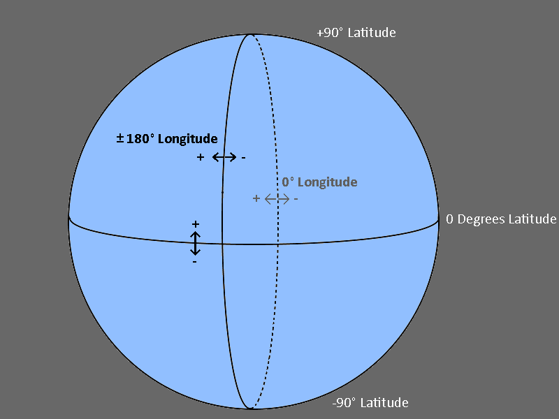
To refresh your memory, lines of longitude run from North to South and lines of latitude run east to west. Longitude values vary between 0 degrees and ±180 degrees with the 0 degrees longitude line running through Greenwich, England. The longitude lines are positive when moving to the east from 0 degrees; the longitude lines are negative when moving to the west from 0 degrees. The Americas have negative longitudes while Israel has positive.
The lines of latitude vary between 0 degrees and ±90 degrees with the latitude line at the Earth's Equator being 0 degrees latitude. Moving north from the Equator the lines of latitude are positive and moving south, the lines of latitude are negative. At the Equator, the circumference of the earth is roughly 24,900 miles. The distance on the earth's surface for each one degree of latitude is about 69 miles (24900/360).
At the Equator, there are 69 miles between each degree of longitude. There is less distance between each degree of longitude as we move away from the Equator. For example, at a 45 degree latitude line, the distance between each degree of longitude is about 49 miles.
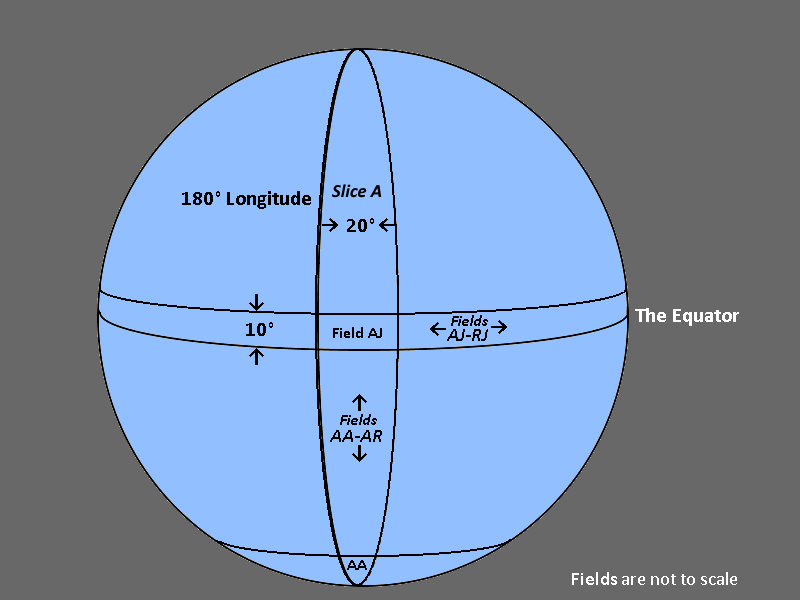
The Maidenhead Grid System converts the current grid into a string containing letters and numbers. We call the first two letters fields. The first field encodes the broad area enclosed by 20 degrees of longitude, starting at and moving east from the 180 degrees longitude line. The designers chose an angle of 20 degrees to get 18 slices around the globe. That distance allowed them to encode an area using the letters "A" through "R". The second field indicates the number of 10 degrees latitude slices counting from the South Pole. The 80 degrees south latitude is "A", the Equator is "I" and the North Pole is "R". As you can see in the diagram, the area for the fields "AJ" has boundary lines of 180 degrees longitude, -160 degrees longitude, +10 degrees latitude, and the Equator.
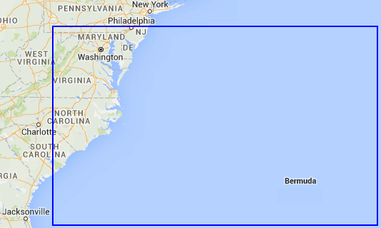
The next image displays the field "FM". As you can see in the image, the area is quite large. It includes parts of the states of New Jersey, Pennsylvania, West Virginia, Maryland, Delaware, Virginia, North Carolina, South Carolina, a chunk of the Atlantic Ocean, and the island of Bermuda. While one can locate a general area of the globe using a two-character Maidenhead field, it is not useful in radio contests.
To get greater definition within a Maidenhead field, like "FM", the designers broke the field down into a 100 smaller areas called squares. They did this by simply adding a pair of numbers, each with a value of 0-9. As with the field characters, in any pair of characters or numbers the first is the movement east changing longitude and the second is the movement north changing latitude.
For the four-character square, each unit change in the first digit changes the longitude by 2 degrees (20 degrees divided by 10). Also, each unit change in the second digit changes the latitude by 1 degrees (10 degrees divided by 10). The name given the combination field and square is the Maidenhead grid square. This diagram defines the grid square for the four-character Maidenhead locator "FM19". The one defines the second square from the left. The nine defines a square at the field's top.
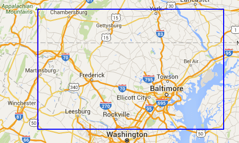
The four-character grid square is the predominate locator used in HF band amateur radio contests. For shorter range VHF/UHF and some local contests, we could add more characters to define an area further. This can also be useful to help a new radio contact understand the area in which you live.
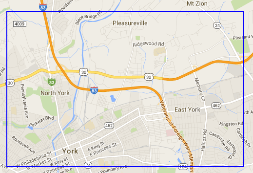
The original designers of the Maidenhead Locator decided to repeat the pattern of letter pair and number pair when it needed further definition. The extra two characters divide the previous longitude and latitude steps by 24, 'A' through 'X'. This value is a good fit for the commonly used degree, minute, and second format. Each degree of latitude or longitude contains 60 minutes. Since each step of longitude was 2 degrees, each step will be 5 minutes (120 minutes/24). Similarly, since each step of latitude was 1 degree, each step will be 2 1/2 minutes (60 minutes/24). Using the proper two characters for East York, gives the map of the more defined six character Maidenhead grid square FM19px.
Now suppose I told you there was a store in my area I liked to visit occasionally and inspect the shelves for deals. Giving you the FM19px grid square would not help much. We can define a smaller grid area by adding two more digits. Using 0 to 9 for each digit divides the FM19px grid square into 100 smaller squares. Each minute of latitude or longitude contains 60 seconds. The size of each new square will then be 30 seconds by 15 seconds. The store's square has an eight-character Maidenhead grid square of FM19px83 as displayed in this map.
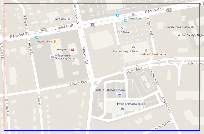
As you can see, we now have greater definition, but not enough definition to locate the store.
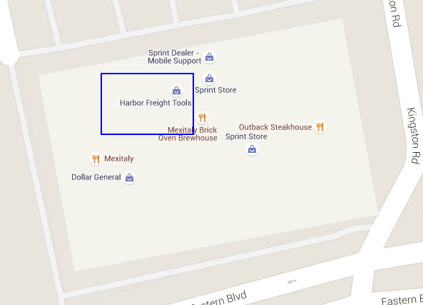
To narrow the store's location down even further, we again add two more letters to create a ten-character Maidenhead locator. The extra two characters divide the previous longitude and latitude steps again by 24, 'A' through 'X'. Since the eight-character square had a size of 30 seconds by 15 seconds, the size of each new 10 character square will be 1 1/4 seconds by 5/8 seconds. In the following map, you can now see the store in the grid square FM19px83pp outlined in blue. You can also see the square is so small the store contains all or parts of several grid squares.
I captured all the maps shown here from a useful K7FRY's Maidenhead locator tool that accepts locators from two to ten characters. Locators greater than 10 characters are too small to view on Google Maps.